
Development of remote analysis data use for planning safe environments
The purpose of the project is to understand how remote data analysis sheds light on the relationships between urban environments, levels and patterns for specific crimes. We examine, with qualitative and quantitative analysis, the relationship between properties of the built environment from extracted and conventional data.
Project leader: Vania A Ceccato
Doctoral Student: Ioannis Ioannidis
Participating researchers: Dr Andrea Nascetti, KTH and Robert Haining, Professor Emeritus, University of Cambridge
Research projects funded by FORMAS (2020-01999)
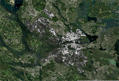
The way we build, monitor and maintain cities impacts critically on how safe they are for their citizens. Current methodologies used to obtain information about the urban environment relevant for crime reduction are time consuming and often costly. Because remote sensing offers a relatively inexpensive and accurate way to capture frequently updated information about the urban environment, we investigate how remote sensing sheds light on the relationships between urban environments and levels and patterns of particular crimes.
We explore, using qualitative and quantitative analysis, the relationship between characteristics of the built environment extracted from remote sensing and conventional data (factors that also affect levels and geography of crime). We identify areas that are most at risk and hence in need of intervention using remote sensing data as a safety monitoring tool, having stakeholders being part of the research in co-creation processes.
The study finalizes with recommendations to stakeholders and 4-6 internationally peer-reviewed academic publications. For theory, findings provide more detailed insights into the role of the environment on crime commission. For practice, they can be helpful for planning new residential areas as well as for tackling safety problems in existing neighborhoods, which is in line with UN-Habitat Safer city program and the key aspirations of Goal 11 of the United Nation’s 2030 Agenda for Sustainable Development.
Publications
Understanding crime patterns using spatial data analysis: Case studies in Stockholm, Sweden. Doctoral thesis of Ioannis Ioannidis
This doctoral thesis integrates high-resolution remote sensing data, complemented by GIS and regression analysis, across multiple Stockholm case studies to reveal how urban form—building density, green spaces, and infrastructure—shapes crime distribution. It highlights the advantages of remote sensing for mapping risk factors and proposes data-driven strategies to inform urban safety planning.
Link: kth.diva-portal.org/smash/record.jsf?pid=diva2%3A1902051&dswid=-8439
Using Remote Sensing Data in Urban Crime Analysis: A Systematic Review of English-Language Literature from 2003 to 2023
This systematic review examines English-language studies (2003–2023) on remote sensing for urban crime analysis, selecting 36 from 910 publications. Findings demonstrate that high-resolution imagery can detect criminogenic features like street networks, vegetation, and luminosity, while noting privacy concerns and validation gaps in methods.
Link: doi.org/10.1177/10575677241237960
Using remote sensing data to derive built-form indexes to analyze the geography of residential burglary and street thefts
Employing Global Human Settlement Layer data, this study develops built-form indexes from satellite imagery to model residential burglary and street theft in Stockholm neighborhoods. Regression analyses, extended by income and transport hub variables, reveal density-crime associations and underscore the need to account for neighborhood type differences.