
Main campus map and travel information
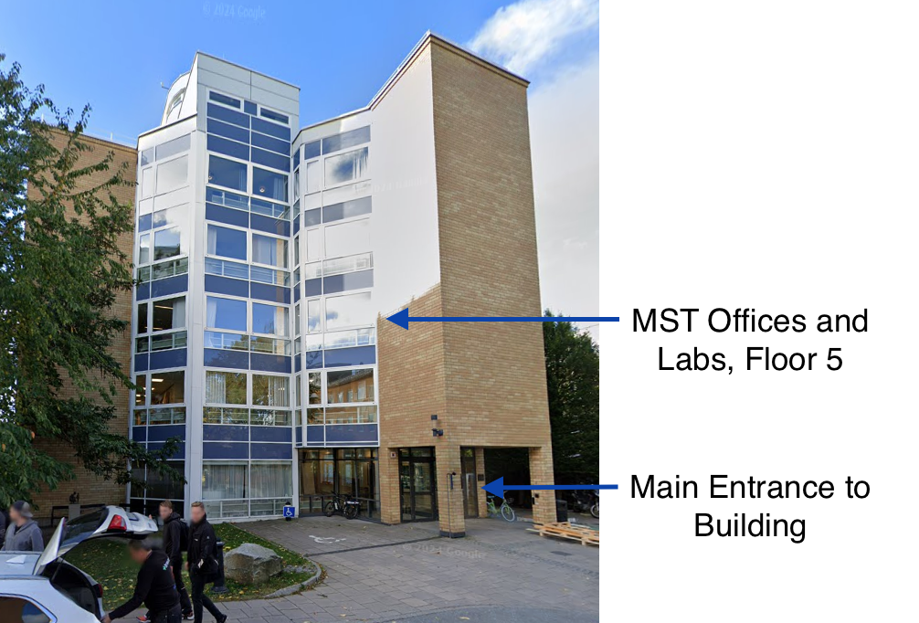
We have our offices and general lab facilities at the main KTH Campus.
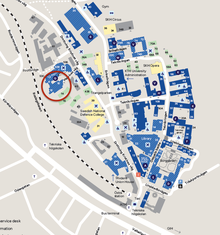
Address
Division of Micro and Nanosystems
KTH School of Electrical Engineering and Computer Science
Malvinas väg 10
SE-100 44 STOCKHOLM
SWEDEN
Link to Google Maps
Campus Map
Travel information
By Subway (T-bana)
On the map you see the underground stop "Tekniska Högskolan", exit "Östra Station" close to the bottom of the Campus map.
The stop 'Tekniska Högskolan' is on the red line, T14, between Mörby Centrum and Fruängen. All the lines connect at "T-Centralen" where you also find the main rail station and terminals for airport trains and busses.
Further information including routes, fares and travel planning can be found on the website of Stockholm's public transport (SL) .
By Bus
The main blue bus lines 4 and 6 have a stop at "Östra station" close to the Underground exit. Also bus lines 67, 72 and 94 stop here.
Further information including routes, fares and travel planning can be found on the website of Stockholm's public transport (SL) .
By Taxi
A taxi from Arlanda airport is between 500 and 750 SEK. Taxis in Stockholm accept credit cards.